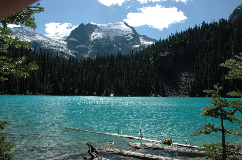
Perhaps the toughest but most rewarding hike in the region is to Upper Joffre Lake. The three lakes in this subalpine chain are strung like a turquoise necklace on the mountainside below the massive Joffre Glacier Group. It's a short 500-metre walk from the parking lot beside Hwy 99 to Lower Joffre Lake, but a stiff 2.5-mile (4-km) hike to Middle Joffre Lake and another 1 mile (1.5 kms) to Upper Joffre, a total distance of 7 miles (11 km) return. The main hiking trail from the parking lot past three lakes to Middle and Upper Joffre Lake is a rough mountain route, which is also popular for snowshoeing. Elevation gain to Upper Joffre Lake from the parking lot is approximately 400 metres. Expect wet trail conditions throughout the year, particularly as you approach Middle Joffre. You have to scramble in places where loose soil conditions make for treacherous footing.
活動人數: 目前已有7-8人,總共不超過16人(四輛車)
行車路線:
To get to the trail-head, when approaching Pemberton from Whistler (from the South), turn right at the T-junction, towards Mount Currie. In town, turn right again towards Duffey Lake and Lillooet, you will travel along a gravel road along the Lillooet River, crossing to the north side river just before Lillooet Lake. The road climbs steeply (paved), follow this and continue a short distance to the BC Parks Joffre Lake parking area, where the first picture below was taken (and waypoint #1 was marked).


 論壇通告:
論壇通告:
 個人空間:
個人空間:

 論壇轉跳:
論壇轉跳:


 贊
贊  花籃
花籃  投訴
投訴 踩
踩  分享
分享